Brazlândia
Appearance
This article includes a list of general references, but it lacks sufficient corresponding inline citations. (July 2013) |
Brazlândia | |
|---|---|
| Região Administrativa de Brazlândia Administrative Region of Brazlândia | |
 Localization of Brazlândia in Federal District | |
| Coordinates: 15°40′30″S 48°12′03″W / 15.67500°S 48.20083°W | |
| Country | |
| Region | Central-West |
| State | |
| Founded | December 10, 1964 |
| Government | |
| • Regional administrator | Devanir Gonçalves de Oliveira[1] |
| Area | |
| • Total | 474.83 km2 (183.33 sq mi) |
| Population (2010)[2] | |
| • Total | 53.874 |
| Time zone | UTC−3 (BRT) |
| Postal Code (CEP) | 72700-000 |
| Area code | +55 61 |
| Website | www.brazlandia.df.gov.br |
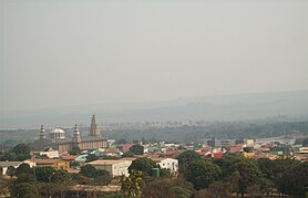
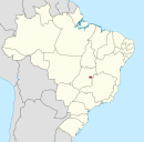
Brazlândia is an administrative region in the Federal District in Brazil. It is bordered by Sobradinho II to the northeast, Brasília to the east, and Taguatinga and Ceilândia to the south. Brazlândia was founded in 1964. Its current administrator is Devanir Gonçalves de Oliveira.
See also
References
- ^ "Perfil do administrador" (in Portuguese). Administração Regional de Brazlândia, DF. Retrieved 2015-01-01.
- ^ "Pesquisa Distrital por Amostra de Domicílios - 2010/2011" (PDF) (in Portuguese). Codeplan. Retrieved 2013-04-09.
External links
Wikimedia Commons has media related to Brazlândia.


