
Deavgay
| Deavgay | |
|---|---|
| De avgay, Kyelbid Ban | |
 Deavgay Location of Deavgay in the Caucasus mountains  Deavgay Deavgay (Republic of Dagestan) | |
| Highest point | |
| Elevation | 4,016 m (13,176 ft) |
| Prominence | 1,251 m (4,104 ft)[1] |
| Coordinates | 41°29′48″N 47°19′34″E / 41.49667°N 47.32611°E[2] |
| Geography | |
| Location | Rutulsky District, Dagestan, Russia |
| Country | Dagestan |
| Parent range | Greater Caucasus |
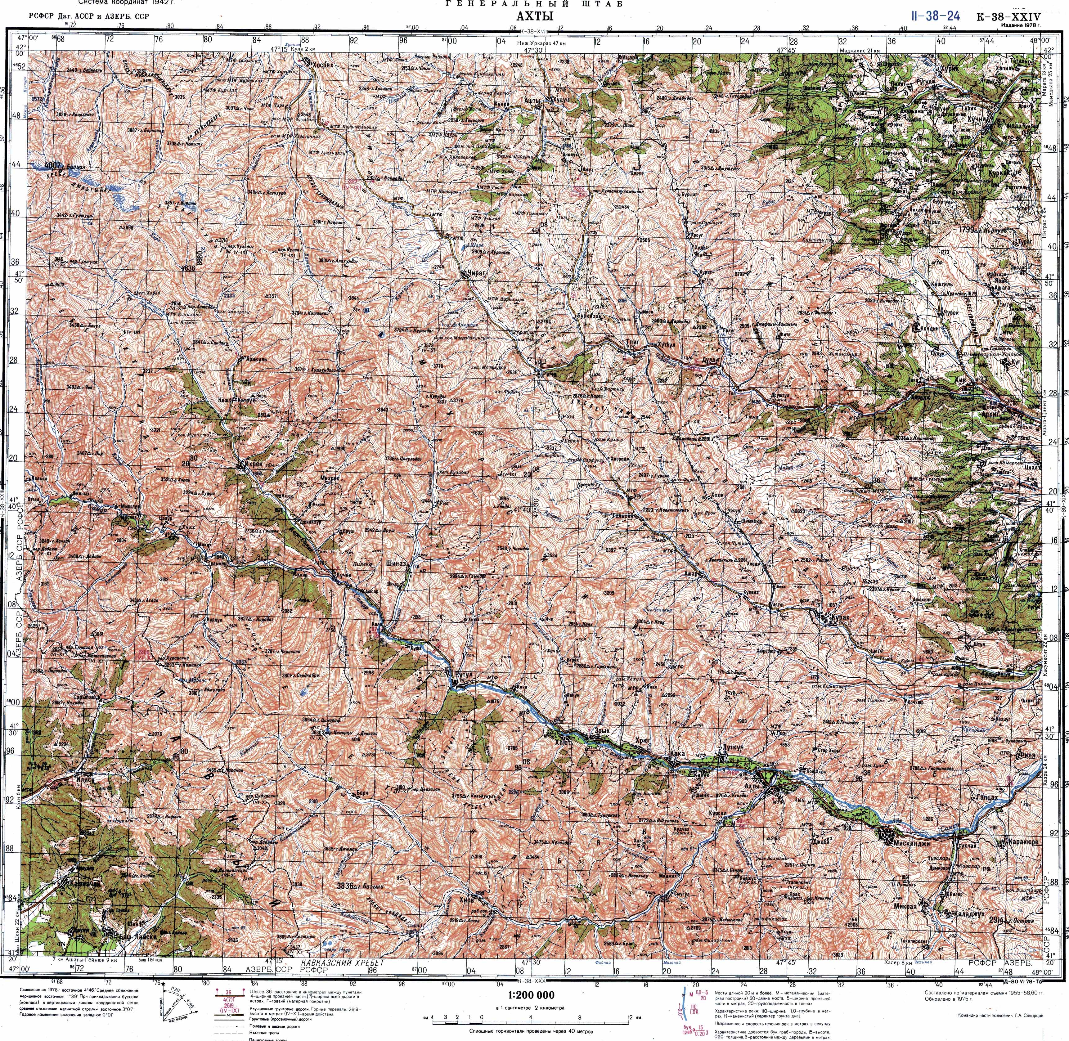
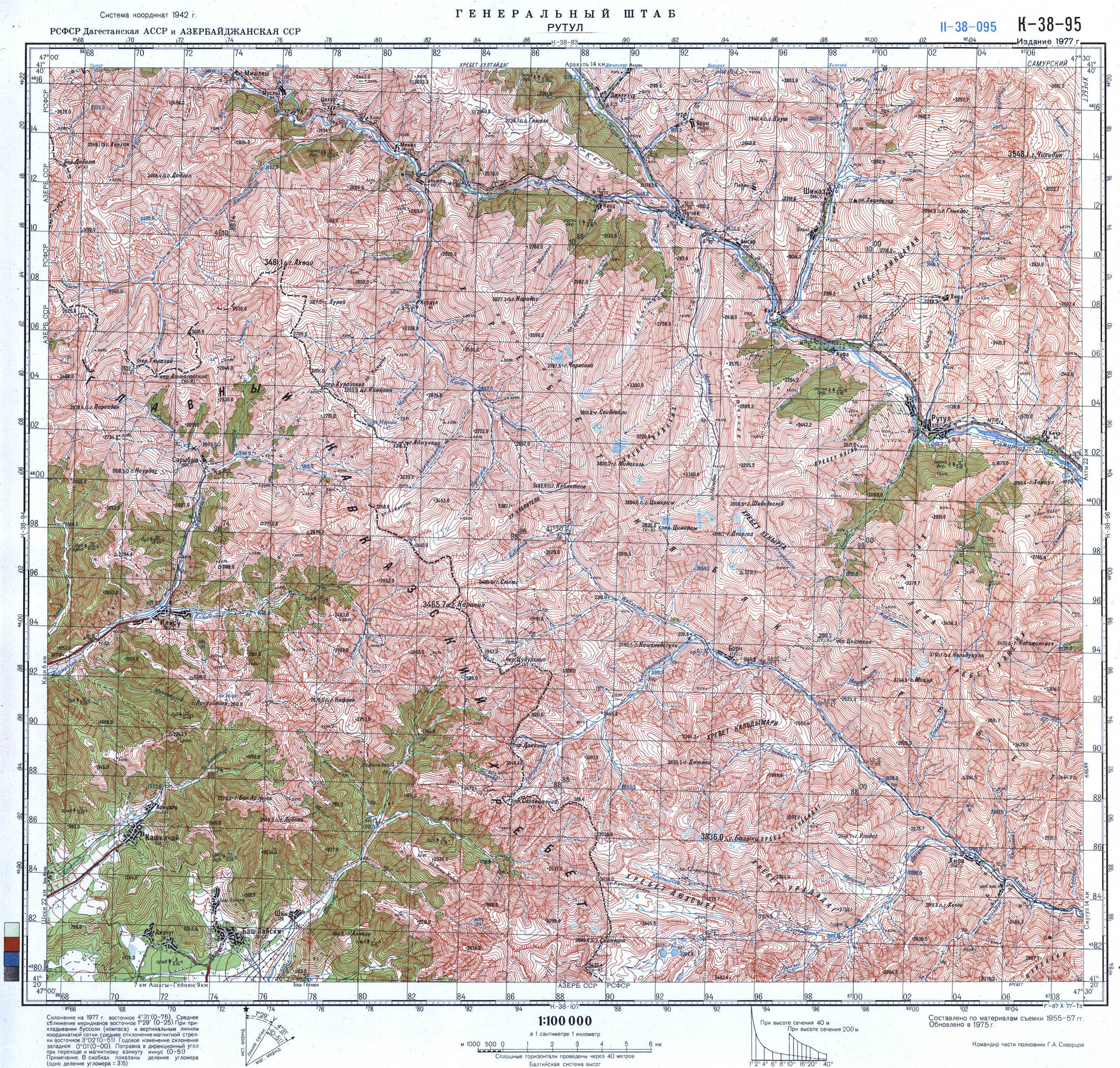
Deavgay (Template:Lang-rut, Template:Lang-rut, Template:Lang-ru) is a mountain located in Dagestan, Russia. At 4,016 m (13,176 ft) elevation, it is the highest point of the Kyabyak range of the Greater Caucasus.[3][4]
Geography

The mountain belongs to the Samur basin. It is in Rutulsky District, 5 km north of the village Borch and 9 km southwest of the larger village Rutul.[3] Deavgay is Dagestan's eleventh-highest mountain and the 193rd-highest in Russia.[5]
References
- ^ "Gora Deavgay". peakvisor.com. PeakVisor.
- ^ Гора Деавгай: Russia, web-page on www.geographic.org
- ^ a b Soviet military map K-38-24 (1:200,000)
- ^ Soviet military map K-38-95 (1:100,000)
- ^ Gora Deavgay, peakery.com
This Republic of Dagestan location article is a stub. You can help Wikipedia by expanding it. |