Shipka (military base)
Appearance
| Shipka | |
|---|---|
| Ukraine | |
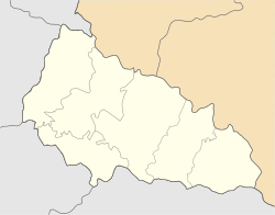
 Map of the installation | |
| Coordinates | 48°22′40″N 22°42′27″E / 48.37768°N 22.70744°E |
| Type | military installation |
| Code | RO-5 |
| Site information | |
| Condition | closed |
| Site history | |
| Built | 1970s |
| Built by | Soviet Union |
Shipka is a small military base near the city of Mukachevo (just outside a small village of Shenborn) in Ukraine. In the past it was a Soviet base that served the Soviet-installed Dnepr radar. In 1992 it was rented to Russia for 15 years. In 2009 the base stopped transferring data to Russia because the Russian authorities refused to continue paying for land lease which was increased in 2006. Formally, in 2008 Russia denounced the Russia-Ukraine agreement about rocket warning systems.[1] [2]
Currently it is a base of the State Space Agency of Ukraine, "Національне космічне агентство України. Західний центр радіотехнічного спостереження", formally part of Mukachevo. [3]
References
- ^ SPRN Radar in Sevastopol ceased data transfer to Russia. Meridian Sevastopol. February 26, 2009
- ^ Денонсация соглашения по системам предупреждения о ракетном нападении не отвечает дружеским отношениям между Украиной и Россией - МИД Украины
- ^ "Закарпатське Мукачево: На вістрі “холодної війни”, або Таємниці "Шипки""
External links
- Ukraine will be blind. Ekonomichna Pravda (Ukrayinska Pravda). June 3, 2013
- Ukraine plans to install radars of new generation before 2017 - NKAU chairman. Interfax Ukraine. June 5, 2013
- Expedition to the secret Dnepr radar. Hi-way. March 2, 2007
- Zakarpattia: Dnepr radar to this day works for Russia. Zakarpattia Portal. November 6, 2008

