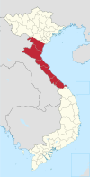
Đức Thọ district
Appearance
You can help expand this article with text translated from the corresponding article in Vietnamese. (March 2009) Click [show] for important translation instructions.
|
Đức Thọ district
Huyện Đức Thọ | |
|---|---|
 Bridge over the La river | |
| Country | |
| Region | North Central Coast |
| Province | Hà Tĩnh |
| Capital | Đức Thọ |
| Area | |
| • Total | 78 sq mi (203 km2) |
| Population (2003) | |
| • Total | 117,730 |
| Time zone | UTC+07:00 (Indochina Time) |
Đức Thọ is a rural district of Hà Tĩnh province in the North Central Coast region of Vietnam. The village of Đông Thái, where the noted 19th-century anti-colonial leader Phan Đình Phùng was born, is located in Đức Thọ. As of 2003 the district had a population of 117,730.[1] The district covers an area of 203 km². The district capital lies at Đức Thọ.[1]
References
- ^ a b "Districts of Vietnam". Statoids. Retrieved March 20, 2009.


