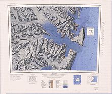
Tucker Glacier

Tucker Glacier is a major valley glacier of Victoria Land, about 144 km (90 mi) long, flowing southeast between Admiralty Mountains and Victory Mountains to the Ross Sea. There is a snow saddle at the glacier's head, just west of Homerun Range, from which Ebbe Glacier flows northwestward.
Explored by NZGSAE, 1957–58, and named by them after Tucker Inlet, the ice-filled coastal indentation at the mouth of this glacier named by Captain James Clark Ross in 1841.
See also
![]() This article incorporates public domain material from "Tucker Glacier". Geographic Names Information System. United States Geological Survey.
This article incorporates public domain material from "Tucker Glacier". Geographic Names Information System. United States Geological Survey.
72°32′S 169°15′E / 72.533°S 169.250°E
