Four Mile Circle
Appearance
| Four Mile Circle | |
|---|---|
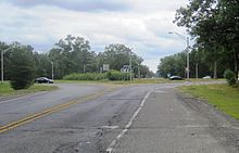
 Circle as seen from westbound Route 70 | |
 | |
| Location | |
| Woodland Township, New Jersey | |
| Coordinates | 39°53′55″N 74°35′48″W / 39.8986°N 74.5967°W |
| Roads at junction | |
| Construction | |
| Type | Traffic circle |
Four Mile Circle is a traffic circle in the U.S. state of New Jersey. It is located at the junction of Route 70, Route 72, Buddtown Road (County Route 644), and New Lisbon Road (County Route 646). This junction is in Woodland Township, within the New Jersey Pine Barrens, near Southampton and Pemberton Townships.[1]
See also
References
- ^ Four Mile Circle, Geographic Names Information System. Accessed November 5, 2015.
