
Rouveen
Rouveen | |
|---|---|
 | |
| Coordinates: 52°36′57″N 6°10′51″E / 52.61583°N 6.18083°E | |
| Country | Netherlands |
| Province | Overijssel |
| Municipality | Staphorst |
| Population | ca. 3,000 |
Rouveen is a village in the Dutch province of Overijssel. It is located in the municipality of Staphorst, about 4 km southwest of that town.[1]
Rouveen and its church featured in documentaries about its resident feminist Hilligje Kok-Bisschop.
Gallery
-
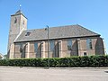 Rouveen, church
 -
 Rouveen, hotel


References
- ^ ANWB Topografische Atlas Nederland, Topografische Dienst and ANWB, 2005.
52°37′N 6°11′E / 52.617°N 6.183°E
This Overijssel location article is a stub. You can help Wikipedia by expanding it. |