Nooksack Cirque
Appearance
| Nooksack Cirque | |
|---|---|
 Nooksack Cirque | |
| Length | 1.5 mi (2.4 km) |
| Width | 2.5 mi (4.0 km) |
| Depth | 3,800 ft (1,200 m) |
| Geology | |
| Type | Glacial |
| Geography | |
| Coordinates | 48°50′14″N 121°34′34″W / 48.8373471°N 121.5762498°W [1] |
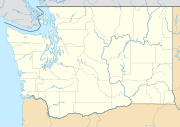
Nooksack Cirque is in North Cascades National Park in the U.S. state of Washington, on the eastern slopes of Mount Shuksan.[2] Nooksack Cirque was formed by glaciers and the East Nooksack Glacier is located in the cirque below the headwall known as Jagged Ridge. The cirque extends from a subpeak of Mount Shuksan called Nooksack Tower to Seahpo Peak, a distance of over 2 mi (3.2 km) in width.[1] Nooksack Cirque streams and meltwater from the East Nooksack Glacier form the headwaters for the Nooksack River.
References
- ^ a b "Nooksack Cirque". Geographic Names Information System. United States Geological Survey, United States Department of the Interior. Retrieved April 20, 2013.
- ^ Mount Shuksan, WA (Map). TopoQwest (United States Geological Survey Maps). Retrieved April 20, 2013.

