Siefker Ridge
Appearance

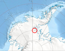
Siefker Ridge (79°9′S 85°19′W / 79.150°S 85.317°W) is a rugged ridge 6 miles (10 km) long, extending northwest from the west part of Anderson Massif in the Heritage Range. Named by the University of Minnesota Geological Party to these mountains, 1963–64, for electronics technician Dennis R. Siefker, U.S. Navy, who was in charge of the automatic weather station at the party's camp at Camp Hills.
![]() This article incorporates public domain material from "Siefker Ridge". Geographic Names Information System. United States Geological Survey.
This article incorporates public domain material from "Siefker Ridge". Geographic Names Information System. United States Geological Survey.
