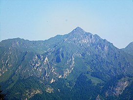
Monte Cadria
Appearance
| Monte Cadria | |
|---|---|
 | |
| Highest point | |
| Elevation | 2,254 m (7,395 ft)[1][2] |
| Prominence | 1,434 m (4,705 ft)[1] |
| Coordinates | 45°56′23″N 10°41′50″E / 45.93972°N 10.69722°E |
| Geography | |
| Location | Trentino-Alto Adige/Südtirol, Italy |
| Parent range | Garda Mountains |
Monte Cadria is a mountain in the Alps located in Italy. It is the highest peak of the Brescia and Garda Prealps.
Geography
Administratively the mountain belongs to the Italian region of Trentino Alto Adige/Südtirol and to the province of Trento.
SOIUSA classification
According to SOIUSA (International Standardized Mountain Subdivision of the Alps) the mountain can be classified in the following way:[3]
- main part = Eastern Alps
- major sector = Central Eastern Alps
- section = Brescia and Garda Prealps
- subsection = Prealpi Gardesane
- supergroup = Prealpi Giudicarie
- group = Gruppo del Cadria
- code = II/C-30.II-A.1
References
- ^ a b "Monte Cadria". Peakbagger.com. Retrieved 2012-05-16.
- ^ Key col: Pradibondo (820 m)
- ^ Marazzi, Sergio (2005). Atlante Orografico delle Alpi. SOIUSA (in Italian). Priuli & Verlucca. p. 275. ISBN 978-88-8068-273-8.
{{cite book}}: Cite has empty unknown parameter:|coauthors=(help)
External links
- Monte Cadria on www.summitpost.org

