Empel en Meerwijk
Appearance
Empel en Meerwijk | |
|---|---|
Former municipality | |
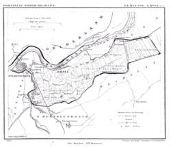
 Empel en Meerwijk in 1868 | |
 | |
| Country | Netherlands |
| Province | North Brabant |
| Municipality | 's-Hertogenbosch |
Empel en Meerwijk is a former municipality of the Dutch province of North Brabant and consisted of Dieskant, Empel, Oud-Empel, Gewande, and Meerwijk. It was situated south of the river Meuse and east of the river Dieze. Since 1971 it has made part of the municipality of 's-Hertogenbosch.
On its area there was a fort called Crèvecoeur. The remainings are still used for military exercises.
The villages of Empel en Meerwijk were a fiefdom originally belonging to Crespin Abbey in northern France.
References
- Equivalent article on the Dutch Wikipedia.

