Artur Alvim
Appearance
Artur Alvim | |
|---|---|
 Location in the city of São Paulo | |
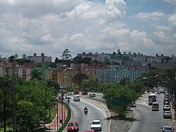
 COHAB Padre Manuel da Nóbrega | |
| Country | Brazil |
| State | São Paulo |
| City | São Paulo |
| Government | |
| • Type | Subprefecture |
| • Subprefect | Cássio Freire Loschiavo |
| Area | |
| • Total | 6.6 km2 (2.5 sq mi) |
| Population (2000) | |
| • Total | 111,210 |
| • Density | 16.850/km2 (43.64/sq mi) |
| HDI | 0.783–medium |
| Website | Subprefecture of Penha |
Artur Alvim is a district in the subprefecture of Penha in the city of São Paulo, placed in the eastern suburban area of the city. It constitutes in a medium-low income neighbourhood, with a mixed space occupied by residences and local commerce. It is served by the Artur Alvim station of the São Paulo metro.
23°32′00″S 46°30′00″W / 23.533333°S 46.500000°W

