
Betzigau
Betzigau | |
|---|---|
_01.JPG) Saint Afra Church | |
 Coat of arms | |
Location of Betzigau within Oberallgäu district 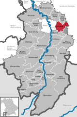 | |
 Betzigau  Betzigau | |
| Coordinates: 47°44′N 10°23′E / 47.733°N 10.383°E | |
| Country | Germany |
| State | Bavaria |
| Admin. region | Schwaben |
| District | Oberallgäu |
| Government | |
| • Mayor | Roland Helfrich (FW) |
| Area | |
| • Total | 29.27 km2 (11.30 sq mi) |
| Elevation | 728 m (2,388 ft) |
| Population (2022-12-31)[1] | |
| • Total | 2,989 |
| • Density | 100/km2 (260/sq mi) |
| Time zone | UTC+01:00 (CET) |
| • Summer (DST) | UTC+02:00 (CEST) |
| Postal codes | 87488 |
| Dialling codes | 0831 |
| Vehicle registration | OA |
| Website | www.betzigau.de |
Betzigau is a municipality in the district of Oberallgäu in Bavaria in Germany.
References
- ^ Genesis Online-Datenbank des Bayerischen Landesamtes für Statistik Tabelle 12411-003r Fortschreibung des Bevölkerungsstandes: Gemeinden, Stichtag (Einwohnerzahlen auf Grundlage des Zensus 2011) (Hilfe dazu).
| International | |
|---|---|
| National | |
This Oberallgäu location article is a stub. You can help Wikipedia by expanding it. |