Protector Shoal
Appearance
| Protector Shoal | |
|---|---|
 Location of Protector Shoal | |
 | |
| Summit depth | 55 metres (180 ft) |
| Height | 3,900 feet (1,200 m) |
| Location | |
| Location | 31 miles (50 km) NW of Zavodovski Island |
| Group | South Sandwich Islands |
| Coordinates | 56°01′S 28°25′W / 56.017°S 28.417°W |
| Country | United Kingdom |
| Geology | |
| Type | Seamount, Submarine volcano |
| Last eruption | 1962 |
| History | |
| Discovery date | 1962 |
| Discovered by | Royal Navy Ice Patrol Vessel H.M.S. Protector |

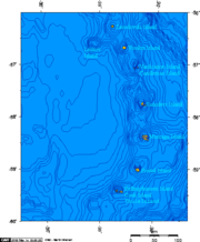
Protector Shoal is a submarine volcano, also called seamount, which rises gently from an ocean depth of 3,900 feet (1,200 m) to about 55 metres (180 ft) below sea level approximately 31 miles (50 km) NW of Zavodovski Island in the South Sandwich Islands chain. The last eruption occurred during March 1962. Protector Shoal is the only volcano in the arc that has erupted rhyolite pumice.
See also
References
- LeMasurier, W. E.; Thomson, J. W., eds. (1990). Volcanoes of the Antarctic Plate and Southern Oceans. American Geophysical Union. p. 512 pp. ISBN 0-87590-172-7.
- "Protector Shoal". Global Volcanism Program. Smithsonian Institution. Retrieved 2017-03-03.
- "Protector Shoal". Volcano World. Oregon State University. Retrieved 2009-04-28.
