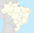
Guará, Federal District
Appearance
Guará | |
|---|---|
 Location of Guará in the Federal District | |
| Coordinates: 15°49′32″S 47°58′48″W / 15.82556°S 47.98000°W | |
| Country | |
| Region | Central-West |
| State | |
| Time zone | UTC-3 (UTC-3) |
| • Summer (DST) | UTC-2 (UTC-2) |
| Area code | +55 61 |
| Website | www |
Guará is an administrative region in the Federal District in Brazil.
See also
References
External links
Wikimedia Commons has media related to Guará, Federal District.

