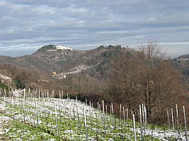
Monte Rua
Appearance
| Monte Rua | |
|---|---|
 | |
| Highest point | |
| Elevation | 416 m (1,365 ft) |
| Coordinates | 45°18′49″N 11°41′21″E / 45.31361°N 11.68917°E |
| Geography | |
| Location | Torreglia, Padua, Veneto, Italy |
| Parent range | Euganean Hills |
Monte Rua is a mountain in the Euganean Hills of Padua Province, Italy. There is a hermitage located on the mountain's summit. The summit has an elevation of 416 m (1,365 ft).

