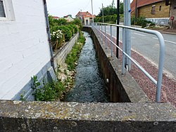
Nave (river)
Appearance
| Nave | |
|---|---|
 Photo required. | |
| Location | |
| Country | France |
| Physical characteristics | |
| Source | |
| • location | Nédonchel |
| Mouth | |
• location | Clarence |
• coordinates | 50°34′45″N 2°33′39″E / 50.57917°N 2.56083°E |
| Length | 22 km (14 mi) |
| Basin features | |
| Progression | Clarence→ Lys→ Scheldt→ North Sea |
The Nave is a river in France, in the department of Pas-de-Calais. It has its source in Nédonchel, then flows into the Clarence up to Gonnehem after a course of 22 kilometres (14 mi).
External links
