Buneva Point


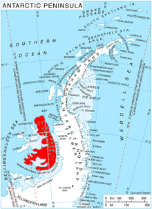
Buneva Point (Template:Lang-bg, ‘Nos Buneva’ \'nos 'bu-ne-va\) is the sharp rocky point on the northwest coast of Alexander Island in Antarctica projecting 1 km west-southwestwards into Lazarev Bay just south of the terminus of Lennon Glacier. It is formed by the north extremity of the homonymous rocky coastal ridge extending 3.7 km in southeast direction.
The feature is named after Mara Buneva (1902-1928), heroine of the Bulgarian liberation movement in Macedonia.
Location
Buneva Point is located at 69°13′48.7″S 72°09′02″W / 69.230194°S 72.15056°W, which is 11 km south of Cape Vostok, 8.8 km northwest of Kamhi Point and 1.75 km northeast of Stoltz Island. British mapping in 1991.
Maps
- British Antarctic Territory. Scale 1:250000 topographic map. Sheet SR19-20/5. APC UK, 1991
- Antarctic Digital Database (ADD). Scale 1:250000 topographic map of Antarctica. Scientific Committee on Antarctic Research (SCAR). Since 1993, regularly upgraded and updated
References
- Bulgarian Antarctic Gazetteer. Antarctic Place-names Commission. (details in Bulgarian, basic data in English)
- Buneva Point. SCAR Composite Gazetteer of Antarctica
External links
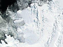
- Buneva Point. Copernix satellite image
This article includes information from the Antarctic Place-names Commission of Bulgaria which is used with permission.
