Saghamo Lake
Appearance
| Saghamo Lake | |
|---|---|
| საღამოს ტბა Error {{native name checker}}: parameter value is malformed (help) | |
 | |
| Coordinates | 41°18′19″N 43°44′24″E / 41.30528°N 43.74000°E |
| Primary inflows | Paravani river |
| Primary outflows | Paravani river |
| Catchment area | 528 km2 (204 sq mi) |
| Basin countries | Georgia |
| Surface area | 4.8 km2 (1.9 sq mi) |
| Average depth | 1.6 m (5 ft 3 in) |
| Max. depth | 2.3 m (7 ft 7 in) |
| Water volume | 7.7 million cubic metres (270×106 cu ft) |
| Surface elevation | 1,996 m (6,549 ft) |
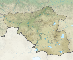
Saghamo Lake (Georgian: საღამოს ტბა) is a lake of Samtskhe-Javakheti, southeastern Georgia, just south of Gamdzani. It covers an area of 458 hectares.[1] It is located north of Madatapa Lake and Biketi Lake. The village of Saghamo lies on its eastern bank.[2]
References
- ^ Anrooy, Raymon van; Millar, Andrés Mena; Spreij, Melvin (2006). Fisheries and aquaculture in Georgia: current status and planning. Food and Agriculture Organization of the United Nations. p. 19. Retrieved 6 October 2011.
- ^ Maps (Map). Google Maps.


