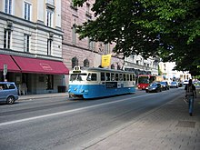
Hamngatan
Appearance
You can help expand this article with text translated from the corresponding article in Swedish. (August 2019) Click [show] for important translation instructions.
|

Hamngatan (Swedish: Port Street) is a street in central Stockholm. It goes from Sergels torg down to Nybroplan, past NK department store, Kungsträdgården, Norrmalmstorg, and Berzelii Park. The Djurgården line travels along this street between Nybroplan and Norrmalmstorg.
