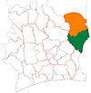
Kouassi-Datékro
Appearance
Kouassi-Datékro | |
|---|---|
Town, sub-prefecture, and commune | |
| Coordinates: 7°49′N 3°32′W / 7.817°N 3.533°W | |
| Country | |
| District | Zanzan |
| Region | Gontougo |
| Department | Koun-Fao |
| Population (2014)[1] | |
| • Total | 25,883 |
| Time zone | UTC+0 (GMT) |
Kouassi-Datékro is a town in eastern Ivory Coast. It is a sub-prefecture and commune of Koun-Fao Department in Gontougo Region, Zanzan District.
In 2014, the population of the sub-prefecture of Kouassi-Datékro was 25,833 [2].
Villages
The xx villages of the sub-prefecture of Kouassi-Datékro and their population in 2014 are [2] :
- Afféry (442)
- Kouassi-Datekro (6 145)
- Ouroutara (1 673)
- Sénandé (1 145)
- Yakassé-Bini (2 093)
- Abongui-Morokro (649)
- Abongui-Tiékoniyaokro (738)
- Amapo Kouassikro (547)
- Comoékro (1 143)
- Djoro-Djoro (1 010)
- Essiantoua (453)
- Guinankro (450)
- Kodoman-Bovouanso (144)
- Koffikokorèkro (115)
- Kokoyakro (474)
- Komambo (1 023)
- Kotronou (774)
- Kouadjakro (607)
- Kouakro-Bovouanso (697)
- Kouassibilékro (434)
- Missoumihian 1 (1 382)
- Missoumihian 2 (662)
- Nambo-Dongbo (1 223)
- Tiéfoumboura (558)
- Yaokro (489)
- Yaotrokro (763)
Notes
- ^ "Côte d'Ivoire". geohive.com. Retrieved 14 December 2015.
- ^ a b "RGPH 2014, Répertoire des localités, Région Gontougo" (PDF). ins.ci. Retrieved 5 August 2019.
[[Category:Communes of
Gontougo]]


