Amajari
Amajari | |
|---|---|
| The Municipality of Amajari | |
 Cachoeira do Paiva | |
 Location of Amajari in the State of Roraima | |
| Coordinates: 03°39′07″N 61°22′15″W / 3.65194°N 61.37083°W | |
| Country | |
| Region | North |
| State | |
| Founded | October 17, 1995 |
| Government | |
| • Mayor | Vera Lúcia (PSC) |
| Area | |
| • Total | 28,472 km2 (10,993 sq mi) |
| Elevation | 100 m (300 ft) |
| Population (2008) | |
| • Total | 7,980 |
| • Density | 0.21/km2 (0.5/sq mi) |
| [1] | |
| Time zone | UTC-4 |
| HDI (2000) | 0.654 – medium[2] |
| Website | www.amajari.rr.gov.br |
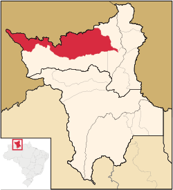
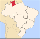
Amajari is a municipality located in the northwest of the state of Roraima in Brazil. Its population is 7,980 and its area is 28,472 km². It is the westernmost municipality in Roraima.
The municipality of Amajari is a region of 8 indigenous segments with a total of 19 indigenous communities living there. The present ethnic groups are the Macuxi, Wapichana, Sapará and Taurepang people. The 8 indigenous segments: TI Araçá, TI Ouro, TI Anaro, TI Ponta da Serra, TI Aningal, TI Garagem, TI Santa Inês and TI Ananás. The indigenous communities that are located in the region are: Araçá, Mutamba, Mangueira, Três Corações, Guariba, Anaro, Ponta da Serra, Urucuri, Juraci, Nova União, Ouro, San Francisco, Cajueiro, Garagem, Ananás, Leão de Ouro, Santa Inês, Aningal and Vida Nova.
Main townships
The following is a list of the main populated places within the municipality and their population according to the census of 2010.[3]
- 1,219 inhabitants - Vila Brasil
- 116 inhabitants - Vila Tepequém
- 587 inhabitants - Vila Três Corações
- 693 inhabitants - Vila do Trairão
References
- ^ 2008 IBGE statistics
- ^ "Archived copy". Archived from the original on 2009-10-03. Retrieved 2009-12-17.
{{cite web}}: CS1 maint: archived copy as title (link) - UNDP - ^ http://www.ibge.gov.br/home/ bestatistica/populacao/censo2010/default.shtm Dados com base em levantamentos utilizando os resultados do Censo 2010 do IBGE. Accessed at 7 fev 2012.


