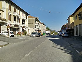
Giovi Pass
Appearance
| Giovi pass | |
|---|---|
 Giovi Pass | |
| Elevation | 472 m (1,549 ft) |
| Traversed by | SS 35 dei Giovi |
| Location | Liguria, Italy |
| Range | Apennines |
| Coordinates | 44°33′09″N 08°56′14″E / 44.55250°N 8.93722°E |
The Giovi Pass is a pass in Italy in the northwestern Ligurian Apennines north of Genoa.
Geography
The pass is at 329 metres (1,080 feet).[1]
A railroad from Genoa to Turin and Milan runs through the pass via a tunnel that is 1,686 metres (5,531 feet) long.[2]
Hiking
The pass is also accessible by off-road mountain paths and is crossed by the Alta Via dei Monti Liguri, a long-distance trail from Ventimiglia (province of Imperia) to Bolano (province of La Spezia).[3]
See also
References
- ^ Webster's New Geographical Dictionary, Third Edition, p. 59
- ^ Webster's New Geographical Dictionary, Third Edition, p. 59
- ^ "Alta via dei monti liguri - Tappa n. 24". www.altaviadeimontiliguri.it. Associazione Alta Via dei Monti Liguri. Archived from the original on March 24, 2015. Retrieved March 7, 2015.
Other Sources
Wikimedia Commons has media related to Giovi Pass.
Webster's New Geographical Dictionary, Third Edition. Springfield, Massachusetts: Merriam-Webster, Inc., 1997. ISBN 0-87779-546-0.

