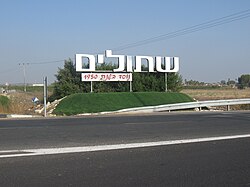
Shtulim
Appearance
Shtulim | |
|---|---|
 | |
| Coordinates: 31°46′24.34″N 34°41′1.82″E / 31.7734278°N 34.6838389°E | |
| Country | Israel |
| District | Southern |
| Council | Be'er Tuvia |
| Affiliation | Moshavim Movement |
| Founded | 1950 |
| Founded by | Yemenite Jewish refugees |
| Population (2022)[1] | 2,174 |
| Website | www.shtulim.co.il |
Shtulim (Template:Lang-he-n, lit. Planted) is a moshav in south-central Israel. Located near Ashdod, it falls under the jurisdiction of Be'er Tuvia Regional Council. In 2022 it had a population of 2,174.[1]
History
The moshav was founded in 1950 by Jewish refugees from Yemen, with the name taken from a passage in the Book of Psalms 92:13: "They are planted in the house of the Lord, they flourish in the courts of our God."[2][3]
Shtulim was built the land of the Palestinian village of Isdud, which was depopulated in 1948.[4]
It has been flooded multiple times due to its proximity to two rivers.[citation needed]
References
Wikimedia Commons has media related to Shtulim.
- ^ a b "Regional Statistics". Israel Central Bureau of Statistics. Retrieved 21 March 2024.
- ^ Mapa's concise gazetteer of Israel (in Hebrew). Yuval Elʻazari (ed.). Tel-Aviv: Mapa Publishing. 2005. p. 552. ISBN 965-7184-34-7.
{{cite book}}: CS1 maint: others (link) - ^ Carta's Official Guide to Israel and Complete Gazetteer to all Sites in the Holy Land. (3rd edition 1993) Jerusalem, Carta, p.422, ISBN 965-220-186-3 (English)
- ^ Khalidi, Walid (1992). All That Remains. Washington D.C.: Institute for Palestine Studies. p. 112. ISBN 0-88728-224-5.

