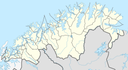
Slåtten
Appearance
Slåtten
Muotki | |
|---|---|
Village | |
 View of the village church | |
Location in Finnmark | |
| Coordinates: 70°45′06″N 24°31′53″E / 70.75167°N 24.53139°E | |
| Country | Norway |
| Region | Northern Norway |
| County | Troms og Finnmark |
| District | Vest-Finnmark |
| Municipality | Måsøy |
| Elevation | 13 m (43 ft) |
| Time zone | UTC+01:00 (CET) |
| • Summer (DST) | UTC+02:00 (CEST) |
| Post Code | 9714 Snefjord |
Slåtten (sometimes Slotten; Template:Lang-sme) is a village in Måsøy Municipality in Troms og Finnmark county, Norway. The village is located along the Revsbotn fjord, along Norwegian County Road 889. It is located about 25 kilometres (16 mi) north of the village of Kokelv and about 39 kilometres (24 mi) south of Havøysund. Slotten Chapel is located in this very small village.
References


