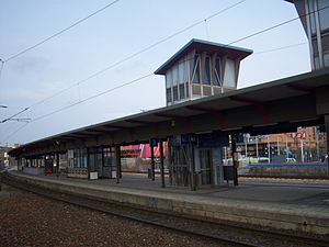
Wien Erzherzog-Karl-Straße railway station
Appearance
Wien Erzherzog-Karl-Straße | |||||||||||
|---|---|---|---|---|---|---|---|---|---|---|---|
 | |||||||||||
| General information | |||||||||||
| Location | 1220 Vienna Austria | ||||||||||
| Coordinates | 48°13′47″N 16°27′11″E / 48.22972°N 16.45306°E | ||||||||||
| Owned by | ÖBB | ||||||||||
| Operated by | ÖBB | ||||||||||
| Platforms | 2 island | ||||||||||
| Tracks | 6 | ||||||||||
| Connections | R | ||||||||||
| Services | |||||||||||
| |||||||||||
| |||||||||||
Wien Erzherzog-Karl-Straße is a railway station serving Donaustadt, the twenty-second district of Vienna.[1]
References
- ^ "Stationsinformation". fahrplan.oebb.at. Retrieved 2020-01-02.

