Tukholka
Appearance
Tukholka | |
|---|---|
Village | |
 Church of the Dormition (wood), Tukholka. Skole Raion, Lviv Oblast. (1858) | |
| Coordinates: 48°52′36″N 23°16′56″E / 48.87667°N 23.28222°E | |
| Country | |
| Oblast | |
| Raion | Skole Raion |
| Area | 3,926 km2 (1,516 sq mi) |
| Elevation | 731 m (2,398 ft) |
| Population | 955 |
| • Density | 24,325/km2 (63,000/sq mi) |
| Website | село Тухолька (Ukrainian) |

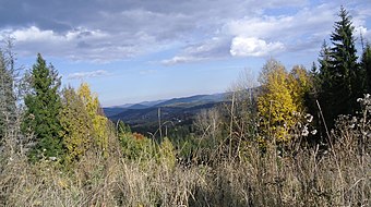
Tukholka (Template:Lang-ua) is a village (selo) in Skole Raion, Lviv Oblast, in western Ukraine. The village Tukholka is located in the Ukrainian Carpathians within the limits of the Eastern Beskids (Skole Beskids) in southern Lviv Oblast in Skole Raion. Remotely from Lviv on 131 km, from Skole - 28 km and from Uzhhorod – 131 km. The village is located in the river valley Brynivka. Local government — Tukholkivska village council.[1]
The first written mention of the settlement dates back to 1552. The first settlers were farmers from the village Tuhlya.[2]
Preserved in the Tukholka a wooden church of the Dormition of Virgin (1858)
People from Tukholka
- Mykola Dychkovskyi (Template:Lang-ua (1910 -1985) — a priest of the village Tukholka, repressed, was exiled to Vorkuta. Dean of city Stryi, the nephew of Cardinal Josyf Slipyj.[2]
Notes
- ^ Tukholkivska village council Archived 2014-12-10 at the Wayback Machine
- ^ Słownik geograficzny Królestwa Polskiego i innych krajów słowiańskich [1] dir.icm.edu.pl. Retrieved 2014-05-19.
References
- Прадідівська слава: база даних українських пам’яток і визначних місць (in Ukrainian)
- weather.in.ua (in Ukrainian)
- Сколівщина.-Львів.1996 (in Ukrainian)
Literature


