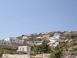
Vourvoulos
Appearance

Vourvoulos (Greek: Βουρβούλος) is a village on the island of Santorini in Greece.[1] It is located 3,7 kilometers northeast of the capital Fira, built on a slope facing the east shore of the island. Vourvoulos is part of the Thira region and had 535 permanent inhabitants according to the Greek census of 2011.[2]
See also
References
- ^ "Vourvoulos". Santorini.com. Retrieved 14 September 2015.
- ^ "Απογραφή Πληθυσμού - Κατοικιών 2011. ΜΟΝΙΜΟΣ Πληθυσμός" (in Greek). Hellenic Statistical Authority.
36°26′06″N 25°26′12″E / 36.43500°N 25.43667°E
