Kagerup railway station
Appearance
This article needs additional citations for verification. (October 2017) |
Kagerup station | ||||||||||||||||
|---|---|---|---|---|---|---|---|---|---|---|---|---|---|---|---|---|
| Railway junction | ||||||||||||||||
 Kagerup railway station in 2015 | ||||||||||||||||
| General information | ||||||||||||||||
| Location | Kagerup Stationsvej Kagerup 3200 Helsinge Denmark | |||||||||||||||
| Coordinates | 55°59′51″N 12°17′9″E / 55.99750°N 12.28583°E | |||||||||||||||
| Owned by | Hovedstadens Lokalbaner | |||||||||||||||
| Operated by | Lokaltog[1] | |||||||||||||||
| Line(s) | Gribskov Line | |||||||||||||||
| Platforms | 1 | |||||||||||||||
| Tracks | 2 | |||||||||||||||
| Services | ||||||||||||||||
| ||||||||||||||||
| ||||||||||||||||
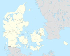
Kagerup railway station is a railway junction located in the central part of the Gribskov forest, about 1 km (0.62 mi) west of the village of Kagerup in North Zealand, Denmark.
Kagerup railway station is located on the Gribskov Line. At Kagerup the railway line from Hillerød splits into two branches to the seaside resort towns of Tisvildeleje and Gilleleje. The train services are operated by the railway company Lokaltog which runs frequent local train services from Hillerød station to Tisvildeleje station and Gilleleje station.[1]
References
- ^ a b "Om Lokaltog". lokaltog.dk (in Danish). Lokaltog A/S. Retrieved 3 October 2017.
External links
![]() Media related to Kagerup Station at Wikimedia Commons
Media related to Kagerup Station at Wikimedia Commons
- (in Danish) Lokaltog
- (in Danish) Gribskovbanen on jernbanen.dk

