
Comberouger
Comberouger | |
|---|---|
 A general view of Comberouger | |
Location of Comberouger  | |
 Comberouger  Comberouger | |
| Coordinates: 43°51′46″N 1°06′13″E / 43.8628°N 1.1036°E | |
| Country | France |
| Region | Occitania |
| Department | Tarn-et-Garonne |
| Arrondissement | Montauban |
| Canton | Beaumont-de-Lomagne |
| Intercommunality | Garonne et Gascogne |
| Government | |
| • Mayor (2001–2008) | Jean-Jacques Laborderie |
| Area 1 | 12.22 km2 (4.72 sq mi) |
| Population (2021)[1] | 268 |
| • Density | 22/km2 (57/sq mi) |
| Time zone | UTC+01:00 (CET) |
| • Summer (DST) | UTC+02:00 (CEST) |
| INSEE/Postal code | 82043 /82600 |
| Elevation | 125–235 m (410–771 ft) (avg. 80 m or 260 ft) |
| 1 French Land Register data, which excludes lakes, ponds, glaciers > 1 km2 (0.386 sq mi or 247 acres) and river estuaries. | |
Comberouger is a commune in the Tarn-et-Garonne department in the Occitanie region in southern France.
Sites en Monuments
-
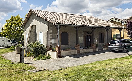 Town hall
 -
 St Barthelemy church
 -
 Inside the church
 -
 War memorial


References
- ^ "Populations légales 2021" (in French). The National Institute of Statistics and Economic Studies. 28 December 2023.
Wikimedia Commons has media related to Comberouger.
| Authority control databases: National |
|---|
This Tarn-et-Garonne geographical article is a stub. You can help Wikipedia by expanding it. |