
Gragnague
Gragnague | |
|---|---|
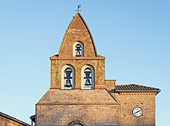
 The church in Gragnague | |
.svg) Coat of arms | |
Location of Gragnague  | |
 Gragnague  Gragnague | |
| Coordinates: 43°41′39″N 1°35′02″E / 43.6942°N 1.5839°E | |
| Country | France |
| Region | Occitania |
| Department | Haute-Garonne |
| Arrondissement | Toulouse |
| Canton | Pechbonnieu |
| Intercommunality | Coteaux du Girou |
| Government | |
| • Mayor (2008–2014) | Daniel Calas |
| Area 1 | 13.04 km2 (5.03 sq mi) |
| Population (2021)[1] | 2,286 |
| • Density | 180/km2 (450/sq mi) |
| Time zone | UTC+01:00 (CET) |
| • Summer (DST) | UTC+02:00 (CEST) |
| INSEE/Postal code | 31228 /31380 |
| Elevation | 136–233 m (446–764 ft) (avg. 144 m or 472 ft) |
| 1 French Land Register data, which excludes lakes, ponds, glaciers > 1 km2 (0.386 sq mi or 247 acres) and river estuaries. | |
Gragnague is a commune in the Haute-Garonne department in southwestern France.
Population
| Year | Pop. | ±% |
|---|---|---|
| 1962 | 401 | — |
| 1968 | 422 | +5.2% |
| 1975 | 596 | +41.2% |
| 1982 | 723 | +21.3% |
| 1990 | 889 | +23.0% |
| 1999 | 1,437 | +61.6% |
| 2008 | 1,588 | +10.5% |
Transport
Monument
-
 Town hall
 -
 Bell gable
 -
 Post office


See also
References
- ^ "Populations légales 2021". The National Institute of Statistics and Economic Studies. 28 December 2023.
Wikimedia Commons has media related to Gragnague.
| Authority control databases: National |
|---|
This Haute-Garonne geographical article is a stub. You can help Wikipedia by expanding it. |