
L'Huisserie
L'Huisserie | |
|---|---|
 The church of Saint Siméon, in L'Huisserie | |
Location of L'Huisserie  | |
 L'Huisserie  L'Huisserie | |
| Coordinates: 48°01′29″N 0°46′03″W / 48.0247°N 0.7675°W | |
| Country | France |
| Region | Pays de la Loire |
| Department | Mayenne |
| Arrondissement | Laval |
| Canton | L'Huisserie |
| Intercommunality | Laval Agglomération |
| Government | |
| • Mayor (2008–2014) | Christian Briand |
| Area 1 | 14.72 km2 (5.68 sq mi) |
| Population (2021)[1] | 4,435 |
| • Density | 300/km2 (780/sq mi) |
| Time zone | UTC+01:00 (CET) |
| • Summer (DST) | UTC+02:00 (CEST) |
| INSEE/Postal code | 53119 /53970 |
| Elevation | 37–118 m (121–387 ft) |
| 1 French Land Register data, which excludes lakes, ponds, glaciers > 1 km2 (0.386 sq mi or 247 acres) and river estuaries. | |
L'Huisserie is a commune in the Mayenne department in north-western France.
It boards the Jouanne river.
Gallery
-
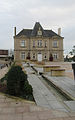 Town Hall

See also
References
- ^ "Populations légales 2021". The National Institute of Statistics and Economic Studies. 28 December 2023.
Wikimedia Commons has media related to L'Huisserie.
| Authority control databases: National |
|---|
This Mayenne geographical article is a stub. You can help Wikipedia by expanding it. |