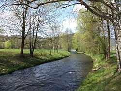
Lohr (river)
Appearance
You can help expand this article with text translated from the corresponding article in German. (September 2011) Click [show] for important translation instructions.
|
| Lohr | |
|---|---|
 The Lohr at Lohr am Main | |
| Location | |
| Country | Germany |
| States | Bavaria, Hesse |
| Physical characteristics | |
| Source | |
| • location | confluence of Flörsbach (right) and the Lohrbach (left) south of Lohrhaupten |
| • elevation | 270 m (890 ft) above sea level at the confluence |
| Mouth | |
• location | Lohr am Main into the Main |
• coordinates | 49°59′41″N 9°34′52″E / 49.9947°N 9.5810°E |
• elevation | 147 m (482 ft) above sea level |
| Length | 18.6 km or 11.6 mi (23.0 km or 14.3 mi including Lohrbach) [1] |
| Basin size | 235.9 km2 (91.1 sq mi) [1] |
| Basin features | |
| Progression | Main→ Rhine→ North Sea |
| Tributaries | |
| • left | Sperkelbach, Rinderbach, Linderbach, Roßbach, Lehngrundbach, Unterer Auwiesengraben |
| • right | Laubersbach, Aubach |
Lohr is a right tributary of the Main in Germany. Although its origins lie in the Main-Kinzig district of Hessen, most of the course of the Lohr is in the Main-Spessart district of Bavaria. Including its source river Lohrbach, it is 23.0 km long.[1]
Course
The Lohr is created by the confluence of the Flörsbach (right) and the Lohrbach (left). Around 1 km below the confluence, the Lohr enters Bavaria. It then flows south to Frammersbach, southeast to Partenstein and continues to Lohr am Main where it discharges into the Main.
See also
References
- ^ a b c Complete table of the Bavarian Waterbody Register by the Bavarian State Office for the Environment (xls, 10.3 MB)
External links
Wikimedia Commons has media related to Lohr (River).
