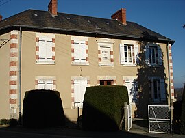
Sazeray
You can help expand this article with text translated from the corresponding article in French. (April 2016) Click [show] for important translation instructions.
|
Sazeray | |
|---|---|
 The town hall in Sazeray | |
| Coordinates: 46°25′47″N 2°03′18″E / 46.4297°N 2.055°E | |
| Country | France |
| Region | Centre-Val de Loire |
| Department | Indre |
| Arrondissement | La Châtre |
| Canton | La Châtre |
| Government | |
| • Mayor (2008–2014) | Didier Brunet |
| Area 1 | 22.69 km2 (8.76 sq mi) |
| Population (2021)[1] | 301 |
| • Density | 13/km2 (34/sq mi) |
| Time zone | UTC+01:00 (CET) |
| • Summer (DST) | UTC+02:00 (CEST) |
| INSEE/Postal code | 36214 /36160 |
| Elevation | 260–432 m (853–1,417 ft) (avg. 438 m or 1,437 ft) |
| 1 French Land Register data, which excludes lakes, ponds, glaciers > 1 km2 (0.386 sq mi or 247 acres) and river estuaries. | |
Sazeray is a commune in the Indre department in central France, in the region of Centre-Val de Loire.
Geography
Location
The commune is situated in the southwest of the department, at the border with the département of Creuse. Nearby communes include Vigoulant, Tercillat, La Cellette, Nouziers, Pouligny Notre-Dame, and Sainte-Sévère-sur-Indre.[2]
Hamlets and lieux-dits
The commune's hamlets and lieux-dits are la Crie, le Grand Correix, and Villard.
Population
| Year | Pop. | ±% |
|---|---|---|
| 1793 | 566 | — |
| 1800 | 400 | −29.3% |
| 1806 | 482 | +20.5% |
| 1821 | 520 | +7.9% |
| 1831 | 577 | +11.0% |
| 1836 | 677 | +17.3% |
| 1841 | 682 | +0.7% |
| 1846 | 667 | −2.2% |
| 1851 | 722 | +8.2% |
| 1856 | 728 | +0.8% |
| 1861 | 732 | +0.5% |
| 1866 | 747 | +2.0% |
| 1872 | 772 | +3.3% |
| 1876 | 802 | +3.9% |
| 1881 | 802 | +0.0% |
| 1886 | 815 | +1.6% |
| 1891 | 795 | −2.5% |
| 1896 | 819 | +3.0% |
| 1901 | 809 | −1.2% |
| 1906 | 798 | −1.4% |
| 1911 | 814 | +2.0% |
| 1921 | 774 | −4.9% |
| 1926 | 784 | +1.3% |
| 1931 | 775 | −1.1% |
| 1936 | 736 | −5.0% |
| 1946 | 687 | −6.7% |
| 1954 | 712 | +3.6% |
| 1962 | 684 | −3.9% |
| 1968 | 607 | −11.3% |
| 1975 | 524 | −13.7% |
| 1982 | 447 | −14.7% |
| 1990 | 370 | −17.2% |
| 1999 | 319 | −13.8% |
| 2006 | 325 | +1.9% |
| 2009 | 328 | +0.9% |
See also
References
- ^ "Populations légales 2021". The National Institute of Statistics and Economic Studies. 28 December 2023.
- ^ "Indre - Département 36 (Région Centre)". www.lion1906.com. Retrieved 2019-06-13.
Wikimedia Commons has media related to Sazeray.


