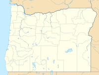
Miles Fire
Appearance
This article needs to be updated. (July 2019) |
| Miles Fire | |
|---|---|
| Date(s) | July 15, 2018 – |
| Location | Rogue River National Forest. Oregon, United States |
| Coordinates | 42°50′53″N 122°42′40″W / 42.848°N 122.711°W |
| Statistics | |
| Burned area | 49,966 acres (202 km2) |
| Impacts | |
| Deaths | None reported |
| Non-fatal injuries | 0 |
| Structures destroyed | 1 |
| Damage | Unknown |
| Map | |
Miles Fire was a wildfire in the Rogue River National Forest in Oregon, United States. As of August 29, 2018 the fire had burned 49,966 acres (202 km2) and was 55% contained.[1]
References
- ^ helpdesk@dms.nwcg.gov, InciWeb developed and maintained by USDA Forest Service, Fire and Aviation Management. "Miles Fire Information - InciWeb the Incident Information System". inciweb.nwcg.gov. Retrieved 2018-08-29.
{{cite web}}: CS1 maint: multiple names: authors list (link)

