Sagter Ems
Appearance
You can help expand this article with text translated from the corresponding article in German. (September 2011) Click [show] for important translation instructions.
|
| Sagter Ems | |
|---|---|
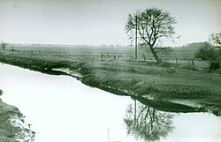
 The Sagter Ems in 1931 | |
 | |
| Location | |
| Country | Germany |
| State | Lower Saxony |
| Physical characteristics | |
| Mouth | |
• location | Leda |
• coordinates | 53°10′40″N 7°40′18″E / 53.1778°N 7.6718°E |
| Basin features | |
| Progression | Leda→ Ems→ North Sea |
Sagter Ems is a river of Lower Saxony, Germany. It is formed at the confluence of the rivers Ohe and Marka west of Friesoythe. At its confluence with the Dreyschloot (a branch of the Soeste), the river Leda is formed. The Sagter Ems is known as the Leda in East Frisia.
See also
