
Gmina Krzyżanowice
Gmina Krzyżanowice
Krzyżanowice Commune | |
|---|---|
 Square in Tworków | |
 Coat of arms | |
| Coordinates (Krzyżanowice): 50°0′N 18°16′E / 50.000°N 18.267°E | |
| Country | |
| Voivodeship | Silesian |
| County | Racibórz |
| Seat | Krzyżanowice |
| Area | |
| • Total | 69.67 km2 (26.90 sq mi) |
| Population (2019-06-30[1]) | |
| • Total | 11,301 |
| • Density | 160/km2 (420/sq mi) |
| Website | http://www.krzyzanowice.pl |
Gmina Krzyżanowice is a rural gmina (administrative district) in Racibórz County, Silesian Voivodeship, in southern Poland, on the Czech border. Its seat is the village of Krzyżanowice, which lies approximately 10 kilometres (6 mi) south of Racibórz and 60 km (37 mi) south-west of the regional capital Katowice.
The gmina covers an area of 69.67 square kilometres (26.9 sq mi), and as of 2019 its total population is 11,301.
Villages
Gmina Krzyżanowice contains the villages and settlements of Bieńkowice, Bolesław, Chałupki, Krzyżanowice, Nowa Wioska, Owsiszcze, Roszków, Rudyszwałd, Tworków and Zabełków.
Neighbouring gminas
Gmina Krzyżanowice is bordered by the town of Racibórz and by the gminas of Gorzyce, Krzanowice and Lubomia. It also borders the Czech Republic.
Gallery
-
 Street in Bolesław
 -
 Street in Bieńkowice
 -
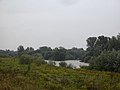 Odra River
,_ulice_II.jpg)
,_ulice_III.jpg)

References
- ^ "Population. Size and structure and vital statistics in Poland by territorial divison in 2019. As of 30th June". stat.gov.pl. Statistics Poland. 2019-10-15. Retrieved 2020-03-19.
Wikimedia Commons has media related to Gmina Krzyżanowice.
| Seat | ||
|---|---|---|
| Other villages | ||
| Urban gminas |
|  |
|---|---|---|
| Urban-rural gminas | ||
| Rural gminas | ||