Rakwa Tso
Appearance
| Rakwa Tso | |
|---|---|
| |
 View of Rakwa Tso | |
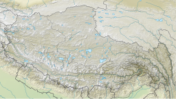
Location of Rakwa in Tibet Autonomous Region. | |
| Location | Chamdo, Tibet Autonomous Region, China |
| Coordinates | 29°27′00″N 96°48′00″E / 29.4500°N 96.8000°E |
| Primary outflows | Parlung Tsangpo |
| Max. length | 25 km (16 mi) |
| Surface area | 27 km2 (10 sq mi) |
| Surface elevation | 3,850 m (12,630 ft) |
| Settlements | Rawu |
Rakwa Tso (Tibetan: རག་ཝྭ་མཚོ, Wylie: rag wwa mtsho; Chinese: 然乌湖; pinyin: Ránwū Hú), also known as Rawu Tso or Ranwu Lake, is a lake in Baxoi County, Chamdo Prefecture, Tibet Autonomous Region, China, to the north of Arza Gongla Glacier, and to the south of Ngagung Tso. The lake covers an area of 27 km2 (10 sq mi), and has an elevation of 3,850 metres (12,630 feet). The lake was created by a landslide dam. Parlung River flows out of the lake.
The lake is within the historical region of Kham. The average temperature is 8.5 °C (47.3 °F), and the rainfall 849.7 mm (33.45 in). It has been a famous tourist destination.

