
Chyšná
Chyšná | |
|---|---|
Municipality | |
 | |
 Flag  Coat of arms | |
 Chyšná | |
| Coordinates: 49°35′31″N 15°6′6″E / 49.59194°N 15.10167°E | |
| Country | |
| Region | Vysočina |
| District | Pelhřimov |
| Area | |
| • Total | 2.83 km2 (1.09 sq mi) |
| Elevation | 485 m (1,591 ft) |
| Population (1.1.2014) | |
| • Total | 113 |
| • Density | 40/km2 (100/sq mi) |
| Postal code | 394 22 |
| Website | http://home.tiscali.cz/chysna/ |
Chyšná is a village and municipality (obec) in Pelhřimov District in the Vysočina Region of the Czech Republic.
The municipality covers an area of 2.83 square kilometres (1.09 sq mi), and has a population of 103 (as at 2 October 2006).
Chyšná lies approximately 20 kilometres (12 mi) north-west of Pelhřimov, 42 km (26 mi) north-west of Jihlava, and 74 km (46 mi) south-east of Prague.
Gallery
-
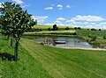 Lido
Lido -
 The memorial "Thanks Amerika"


References
Wikimedia Commons has media related to Chyšná.
| Authority control databases: National |
|---|
This Vysočina Region location article is a stub. You can help Wikipedia by expanding it. |