Jump to content

Hažín nad Cirochou

Coordinates: 48°56′N 21°58′E / 48.933°N 21.967°E / 48.933; 21.967
From Wikipedia, the free encyclopedia

This is an old revision of this page, as edited by Ser Amantio di Nicolao (talk | contribs) at 00:12, 1 April 2020 (→‎External links: add authority control). The present address (URL) is a permanent link to this revision, which may differ significantly from the current revision.

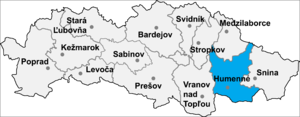
Location of Humenné District in the Prešov Region.

Hažín nad Cirochou is a village and municipality in Humenné District in the Prešov Region of north-east Slovakia.

History

In historical records the village was first mentioned in 1451.

Geography

The municipality lies at an altitude of 167 metres and covers an area of 7.181 km². It has a population of about 710 people.

External links

48°56′N 21°58′E / 48.933°N 21.967°E / 48.933; 21.967