
Horní Kruty

Horní Kruty is a small village set in hilly countryside in central Bohemia in the Czech Republic. The area of Hornokrutsko consists of villages Horní Kruty, Dolní Kruty, Přestavlky, Bohouňovice II., Újezdec, Březinka and Kamenná.
The municipality covers an area of 14.32 square kilometres (5.53 sq mi) and as of 2010 it had a population of 518. The first written record of the village is from 1228.
Gallery
-
 Front view of the building
 -
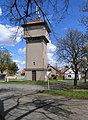 Water tower
 -
 North view of the building


External links
Wikimedia Commons has media related to Horní Kruty.
- (in Czech) www.hornikruty.cz
49°55′29″N 14°57′19″E / 49.92472°N 14.95528°E
| Authority control databases: National |
|---|