Ruprechtov
Appearance
Ruprechtov | |
|---|---|
Village | |
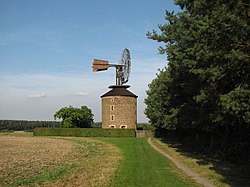
 Windmill | |
| Coordinates: 49°19′32″N 16°50′35″E / 49.32556°N 16.84306°E | |
| Country | Czech Republic |
| Region | South Moravia |
| District | Vyškov |
| Government | |
| • Mayor | Světlana Švarcová |
| Area | |
| • Total | 11.47 km2 (4.43 sq mi) |
| Elevation | 514 m (1,686 ft) |
| Population | |
| • Total | 584 |
| Website | Official website |
Ruprechtov is a village in the Vyškov District of the Czech Republic. It has about 560 inhabitants.
Geography
Ruprechtov is located in Drahanská vrchovina, between Blansko a Vyškov
History
The first epistolary notation exists from the 1446.
Monuments
- Crucifix on the road to Ježkovice
- Crucifix on the road to Podomí
- Crucifix on the square near the belfry
- Sculpture of Saint Norbert
- Windmill Ruprechtov
External links
Wikimedia Commons has media related to Ruprechtov.


