O'Donnell (Madrid Metro)

Coordinates: 40°25′22″N 3°40′07″W / 40.4228927°N 3.6685926°W / 40.4228927; -3.6685926
From Wikipedia, the free encyclopedia

This is an old revision of this page, as edited by AngryHarpy (talk | contribs) at 20:13, 4 April 2020. The present address (URL) is a permanent link to this revision, which may differ significantly from the current revision.

O'Donnell
Madrid Metro station
General information
LocationRetiro / Salamanca, Madrid
Spain
Coordinates40°25′22″N 3°40′07″W / 40.4228927°N 3.6685926°W / 40.4228927; -3.6685926
Owned byCRTM
Operated byCRTM
Construction
AccessibleNo
Other information
Fare zoneA
History
Opened10 October 1979 (1979-10-10)
Services
Preceding station   Madrid Metro   Following station
Template:Madrid Metro lines
Location
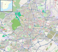
O'Donnell is located in Madrid
O'Donnell
O'Donnell
Location within Madrid

O'Donnell is a station on Line 6 of the Madrid Metro, located near the Royal Mint of Spain and the intersection of O'Donnell and Doctor Esquerdo streets in fare Zone A.[1] It serves the neighborhoods of Goya and Fuente del Berro in the Salamanca district and the neighborhood of Ibiza in the Retiro district of Madrid. The station was inaugurated on 10 October 1979 along with all of the other stations between Pacífico and Cuatro Caminos.[2] The station is named after O'Donnell street, which in turn is named after the 19th-century Spanish politician Leopoldo O'Donnell.

References

  1. ^ "Línea 6 Circular". Metro de Madrid. Retrieved 5 September 2019.{{cite web}}: CS1 maint: url-status (link)
  2. ^ "El Rey inauguró la nueva línea de Metro entre Pacífico y Cuatro Caminos" [King inaugurates new Metro line between Pacífico and Cuatro Caminos]. El País (in Spanish). 11 October 1979. Retrieved 7 March 2014.