Wolthausen
Appearance
Wolthausen | |
|---|---|
Subdivision of Winsen (Aller) | |
| Coordinates: 52°41′39″N 9°58′48″E / 52.69417°N 9.98000°E | |
| Country | Germany |
| State | Lower Saxony |
| District | Celle |
| Municipality | Winsen (Aller) |
| Elevation | 39 m (128 ft) |
| Time zone | UTC+01:00 (CET) |
| • Summer (DST) | UTC+02:00 (CEST) |
| Postal codes | 29308 |
| Dialling codes | 05143 |


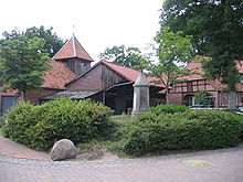
Wolthausen is a village in the borough of Winsen (Aller) in the district of Celle in the north German state of Lower Saxony. It lies on the River Örtze in the Aller valley and on the B 3 federal road.
Politics
Wolthausen has a joint council with the neighbouring village of Stedden.
The council chair is Christian Peters (CDU).


