
Dickinson County Healthcare System
| Dickinson County Healthcare System | |
|---|---|
 | |
 | |
| Geography | |
| Location | Iron Mountain, Michigan, United States |
| Organization | |
| Care system | Public |
| Type | Community |
| Services | |
| Beds | 49 |
| Links | |
| Website | http://www.dchs.org/ |
| Lists | Hospitals in Michigan |
The Dickinson County Healthcare System is a hospital located in Iron Mountain, Michigan.[1]
Images[edit]
-
 Sign
Sign -
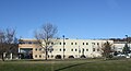 Side view


References[edit]
External links[edit]
45°48′35.6″N 88°02′40.5″W / 45.809889°N 88.044583°W
This article relating to a hospital in Michigan is a stub. You can help Wikipedia by expanding it. |