Boma National Park
| Boma National Park | |
|---|---|
| Coordinates | 6°29′20″N 33°54′50″E / 6.489°N 33.914°E[1] |
| Area | 22,800 km2 (8,800 sq mi) |
| Established | 1977 |
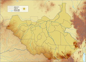
Boma National Park is a protected area in eastern South Sudan near the Ethiopian border. It was established in 1977 and covers 22,800 km2 (8,800 sq mi) of grasslands and floodplains.[2]
Wildlife
The park is an important refuge for white-eared kob, tiang, and Mongalla gazelle. Other large mammals are buffalo, elephant, African leopard, Nubian giraffe, oryx, hartebeest, Northeast African cheetah,[3] common eland, Lelwel hartebeest, maneless zebra, waterbuck, Grant's gazelle, Lesser kudu, bongo, Giant eland, and Nile lechwe.[4] It is also an important bird area; avifauna includes Ruppell's vulture and the black-chested snake eagle.[5][6] The neighboring Gambela National Park in Ethiopia protects similar species.
Since 2005, the protected area is considered a lion conservation unit together with Gambella National Park.[7]
- White-eared kob
The most prominent species of the Boma National Park is the white-eared kob (Kobus kob leucotis) antelope. A UNEP study reports that the white-eared kob is found mostly to the east of Nile River in South Sudan within the clay plains and wetlands; though occurring in substantial numbers in the Boma National Park, it is reported to be found more outside the protected area. Its migration route and population during the summer and monsoon seasons have been recorded. Its migration route over the dry and wet seasons, which is dictated by the variation in rainfall and flooding from year to year, extends over 1,600 km (990 mi); it encompasses different ecoregions in various tribal belts, and exposes the species to hunting threats. In comparison to the wet season count of 680,716 in 1980 (849,365 in dry season), the UNEP survey of 2001 reported only 176,120 during the wet season (although the two studies are not directly comparable).[8]
The wildlife in this park has provided bush meat, which is not only a dominant food need for many people of Southern Sudan, but also an avenue of illegal trading supported by wildlife hunting that has caused biodiversity damage. The park accounts for the greatest concentration of wildlife in the country, particularly of mammals.[5]
References
- ^ Openstreetmap contributors
- ^ World Database on Protected Areas[permanent dead link]
- ^ "Peter Amun: Bushmeat Field Assessment from Boma National Park in South Sudan. BEAN Bushmeat Factsheet 2009" (PDF). Archived from the original (PDF) on 2011-07-26. Retrieved 2010-07-29.
- ^ Field & Stream. February 1973. pp. 172–. ISSN 8755-8599. Retrieved 31 July 2011.
- ^ a b Amum, P.; Eves, H.E. (2009). "BEAN Bushmeat Fact Sheet: Boma National Park Assessment, Southern Sudan. Bushmeat-free Eastern Africa Network" (PDF). bushmeatnetwork.org. Archived from the original (pdf) on 26 July 2011. Retrieved 31 July 2011.
- ^ Ferguson-Lees, James; Christie, David A. (17 September 2001). Raptors of the world. Houghton Mifflin Harcourt. pp. 428, 450–. ISBN 978-0-618-12762-7. Retrieved 31 July 2011.
- ^ IUCN Cat Specialist Group (2006). Conservation Strategy for the Lion in West and Central Africa. Yaounde, Cameroon: IUCN.
- ^ UNEP. "Wildlife and Protected Area Management" (pdf). Retrieved 1 August 2011.

