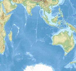
Maldive Islands
 Satellite image of the Maldive Islands | |
| Geography | |
|---|---|
| Location | Indian Ocean |
| Coordinates | 3°12′N 73°13′E / 3.20°N 73.22°E |
| Total islands | 1190 |
| Administration | |
The Maldive Islands is a group of islands in the Indian Ocean composing today's Republic of Maldives and the island of Minicoy in the Union Territory of Lakshadweep.
Historically Minicoy was within the domain of the sultans of the Maldives. In 1790 Minicoy was surrendered to the Court of Directors of the East India Company and thus became part of the territory of the Madras presidency of British India.[1] In 1858, following the Indian Mutiny of 1857, the control of British India transferred from the East India Company to the British Crown, and a decade later Queen Victoria was proclaimed empress.[2]
The Maldive Islands became a British protectorate in 1887.[3] At the time of the partition of India of 1947, Minicoy transferred automatically to the new Dominion of India, while the remainder of the Maldives continued as a self-governing sultanate, under the status of British protection, ultimately achieving full independence in 1965.[3]
Linguistically, Minicoy remains linked to the rest of the island group.
See also
References
- ^ "Minicoy History Pages". www.maldivesroyalfamily.com. Retrieved 2019-01-20.
- ^ Marshall, Peter (17 February 2011). "British History in depth: British India and the 'Great Rebellion'". www.bbc.co.uk. Retrieved 2019-01-20.
- ^ a b Maldives Independent - Timeline – Story of Independence

