Baraize
Baraize | |
|---|---|
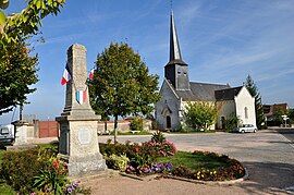
 The church and war memorial in Baraize | |
| Coordinates: 46°29′22″N 1°33′45″E / 46.4894°N 1.5625°E | |
| Country | France |
| Region | Centre-Val de Loire |
| Department | Indre |
| Arrondissement | Châteauroux |
| Canton | Argenton-sur-Creuse |
| Government | |
| • Mayor (2008–2014) | Lionel Perrot |
| Area 1 | 16.39 km2 (6.33 sq mi) |
| Population (2021)[1] | 362 |
| • Density | 22/km2 (57/sq mi) |
| Time zone | UTC+01:00 (CET) |
| • Summer (DST) | UTC+02:00 (CEST) |
| INSEE/Postal code | 36012 /36270 |
| Elevation | 123–292 m (404–958 ft) (avg. 244 m or 801 ft) |
| 1 French Land Register data, which excludes lakes, ponds, glaciers > 1 km2 (0.386 sq mi or 247 acres) and river estuaries. | |
Baraize is a commune in the Indre département in central France.
Population
| Year | Pop. | ±% |
|---|---|---|
| 1793 | 660 | — |
| 1800 | 579 | −12.3% |
| 1806 | 612 | +5.7% |
| 1821 | 758 | +23.9% |
| 1831 | 781 | +3.0% |
| 1836 | 806 | +3.2% |
| 1841 | 809 | +0.4% |
| 1846 | 825 | +2.0% |
| 1851 | 826 | +0.1% |
| 1856 | 814 | −1.5% |
| 1861 | 818 | +0.5% |
| 1866 | 849 | +3.8% |
| 1872 | 782 | −7.9% |
| 1876 | 795 | +1.7% |
| 1881 | 801 | +0.8% |
| 1886 | 827 | +3.2% |
| 1891 | 841 | +1.7% |
| 1896 | 780 | −7.3% |
| 1901 | 719 | −7.8% |
| 1906 | 732 | +1.8% |
| 1911 | 716 | −2.2% |
| 1921 | 647 | −9.6% |
| 1926 | 633 | −2.2% |
| 1931 | 580 | −8.4% |
| 1936 | 535 | −7.8% |
| 1946 | 515 | −3.7% |
| 1954 | 498 | −3.3% |
| 1962 | 428 | −14.1% |
| 1968 | 389 | −9.1% |
| 1975 | 417 | +7.2% |
| 1982 | 404 | −3.1% |
| 1990 | 337 | −16.6% |
| 1999 | 301 | −10.7% |
| 2009 | 313 | +4.0% |
See also
References
- ^ "Populations légales 2021". The National Institute of Statistics and Economic Studies. 28 December 2023.
Wikimedia Commons has media related to Baraize.


