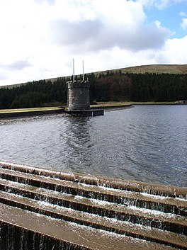
Cantref Reservoir
Appearance
| Cantref Reservoir | |
|---|---|
 | |
| Location | Wales |
| Coordinates | 51°49′55″N 3°27′40″W / 51.83194°N 3.46111°W |
| Type | reservoir |
| Basin countries | United Kingdom |
Cantref Reservoir is the middle of the three reservoirs in the Taff Fawr valley in Wales. It is owned by Welsh Water. It is located in the Brecon Beacons National Park, mostly in the Powys unitary authority area and within the historic county boundaries of Breconshire. Part of the south west corner is in the Rhondda Cynon Taff unitary authority area.
A public footpath crosses the dam and links with the Taff Trail and the Navvies Line paths.
External links
- "Welsh Water Recreation Guide" (PDF). Archived from the original (PDF) on 2011-09-28. Retrieved 2011-07-31. (409 KiB)
- www.geograph.co.uk : photos of the Cantref reservoir and surrounding area
