Köln-Nippes station
Appearance
Template:S-Bahn-NRW Köln-Nippes | ||||||||||||||||
|---|---|---|---|---|---|---|---|---|---|---|---|---|---|---|---|---|
| Through station | ||||||||||||||||
 | ||||||||||||||||
| General information | ||||||||||||||||
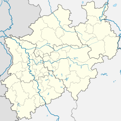
| Location | Nippes, Cologne (Köln), NRW Germany | |||||||||||||||
| Coordinates | 50°57′32″N 6°56′30″E / 50.9588°N 6.9418°E | |||||||||||||||
| Line(s) | ||||||||||||||||
| Other information | ||||||||||||||||
| Station code | 3337 | |||||||||||||||
| DS100 code | KKN [1] | |||||||||||||||
| IBNR | 03372 | |||||||||||||||
| Category | 4 [2] | |||||||||||||||
| Fare zone | VRS: 2100[3] | |||||||||||||||
| Website | www.bahnhof.de | |||||||||||||||
| History | ||||||||||||||||
| Opened | 15 November 1855 [4] | |||||||||||||||
| Services | ||||||||||||||||
| ||||||||||||||||
| ||||||||||||||||
Köln-Nippes is a passenger and freight railway station situated in Nippes, the northern border of the city of Cologne in western Germany. It is served by the S6 and S11 lines of the Rhine-Ruhr S-Bahn.[5][6]
References
- ^ Eisenbahnatlas Deutschland (German railway atlas) (2009/2010 ed.). Schweers + Wall. 2009. ISBN 978-3-89494-139-0.
- ^ "Stationspreisliste 2024" [Station price list 2024] (PDF) (in German). DB Station&Service. 24 April 2023. Retrieved 29 November 2023.
- ^ "VRS-Gemeinschaftstarif" (PDF) (in German). Verkehrsverbund Rhein-Sieg. 20 April 2020. p. 202. Retrieved 9 May 2020.
- ^ "Köln-Nippes station operations". NRW Rail Archive (in German). André Joost. Retrieved 24 November 2013.
- ^ "S-Bahn network map for the Cologne/Bonn Region" (PDF) (in German). Deutsche Bahn. 24 November 2013. Archived from the original (PDF) on 16 June 2012.
- ^ "Köln-Nippes station". NRW Rail Archive (in German). André Joost. 24 November 2013.
External links

